YELLOWSTONE RIVER CUMULATIVE EFFECTS ANALYSIS
Flow
Flow
HOME EXHIBITION VOICES OF THE RIVER SYMPOSIUM MIXING OIL & WATER FILM NIGHT WORDS ON WATER: POETRY & JAZZ IN CONCERT LIVING IN HARMONY ON THE YELLOWSTONE FILM
YOUTH OUTREACH READING AREAS YELLOWSTONE RIVER CUMULATIVE EFFECTS ANALYSIS MORE
YOUTH OUTREACH READING AREAS YELLOWSTONE RIVER CUMULATIVE EFFECTS ANALYSIS MORE
YELLOWSTONE RIVER CUMULATIVE EFFECTS ANALYSIS (CEA)
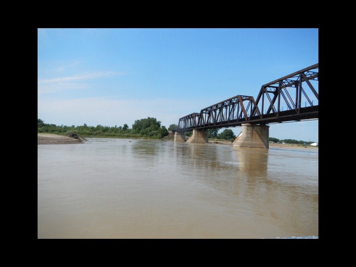
"Since the 1990s, the Yellowstone River Corridor has experienced damaging floods and increased development pressures. In 2004, the Yellowstone River Conservation District Council entered into a cost-sharing agreement with the Omaha District to study those cumulative impacts in order to provide a scientific basis for developing recommended management practices along the river. The Yellowstone River Corridor Study, which included participation from multiple federal, state and local agencies as well as non-profit organizations and businesses, focuses on 12 counties along the main stem river corridor from Yellowstone National Park to the confluence with the Missouri River in North Dakota."
The 16-year long CEA is the largest, most comprehensive study of a water shed in the world and includes a cultural inventory conducted by a team led by MSUBillings' Dr. Susan Gilbertz (see below). From this massive study, Yellowstone River Recommended Practices were created "to promote an ecologically sustainable river while preserving the economic viability of residents and communities that rely on the river." (see below).
The final draft of the study is available as a PDF download at http://cdm16021.contentdm.oclc.org/cdm/ref/collection/p16021coll7/id/2351
For more information about the CEA, please contact Warren Kellogg, Chair, Technical Advisory Group, Yellowstone River Community Effects Analysis
warrenkellogg[at]q.com
YELLOWSTONE RIVER CULTURAL INVENTORY - 2006 (Overall Summary)
From the introduction:
"The Yellowstone River has a long history of serving human needs. Native Americans named it the Elk River because of its importance as a hunting environment. William Clark explored much of the river in the spring of 1806 and found it teaming with beavers. By 1906, the US Bureau of Reclamation was sponsoring diversion projects that tapped the river as a source of irrigation waters. The river then enabled “twentieth-century progress” and today it supports many nearby agricultural, recreational and industrial activities, as well as many activities on the Missouri River.
Management of the shared resources of the Yellowstone River is complicated work. Federal and state interests compete with one another, and they compete with local and private endeavors. Legal rights to the water are sometimes in conflict with newly defined needs, and, by Montana law, the public is guaranteed access to the river even though 84 percent of the riverbank is privately owned.
Interestingly, in spite of the many services it provides, the Yellowstone River in 2006 remains relatively free-flowing. This fact captures the imaginations of many people who consider its free-flowing character an important link between contemporary life and the unspoiled landscapes of the Great American West. As a provider, as a symbol of progress, as a shared resource, as a management challenge, and as a symbol of our American heritage, the Yellowstone River is important.
The Yellowstone River Cultural Inventory—2006 documents the variety and intensity of different perspectives and values held by people who share the Yellowstone River. Between May and November of 2006, a total of 313 individuals participated in the study. They represented agricultural, civic, recreational, or residential interest groups. Also, individuals from the Crow and the Northern Cheyenne tribes were included.
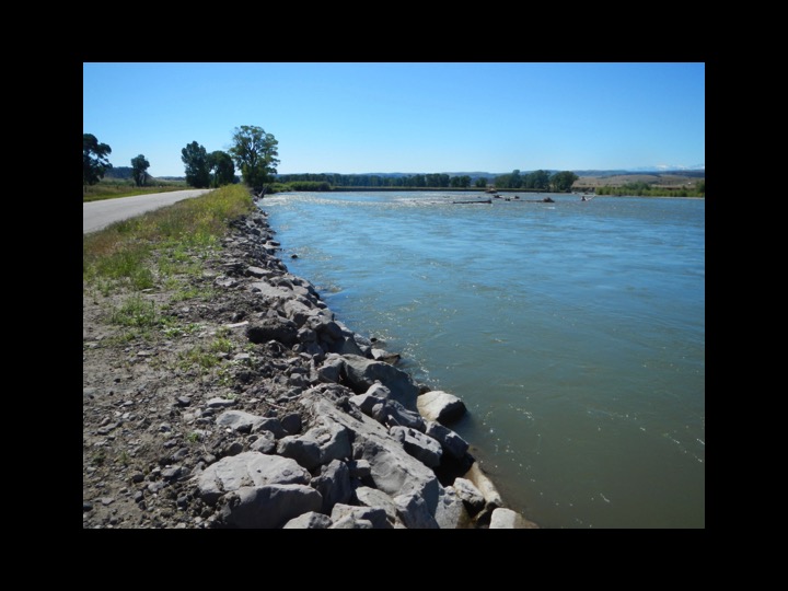
There are three particular goals associated with the investigation. The first goal is to document how the people of the Yellowstone River describe the physical character of the river and how they think the physical processes, such as floods and erosion, should be managed. Within this goal, efforts have been made to document participants’ views regarding the many different bank stabilization techniques employed by landowners. The second goal is to document the degree to which the riparian zone associated with the river is recognized and valued by the participants. The third goal is to document concerns regarding the management of the river’s resources. Special attention is given to the ways YRCI 2006: Overall Summary 2 in which residents from diverse geographical settings and diverse interest groups view river management and uses. The results illustrate the commonalities of thought and the complexities of concerns expressed by those who share the resources of the Yellowstone River.
This overall summary provides several overviews of the Yellowstone River Cultural Inventory—2006. The first section provides an explanation of the research approach. It explains how the river was divided into five geographic segments, the recruitment of Native Americans and the efforts to include individuals from four interest groups: agriculturalists, local civic leaders, recreationalists and residentialists, within each of the five geographic segments.
The second section of this overall summary describes the steps taken in analyzing the textual data of the project. Well over 2700 pages of interview texts were generated by this project. The content of the interview texts was distilled by way of analytical steps that would retain geographical and interest group integrity.
The third section includes a brief overview of the key concerns and implications of the evidence gathered for each group: agriculturalists, local civic leaders, recreationalists, residentialists and Native Americans. Detailed river-length analyses for each group are found in later sections of this volume.
Overviews of the geographic segment analyses are found in the fourth section. These overviews describe the major themes of concern among the people of each segment: Missouri River to Powder River, Powder River to Big Horn River, Big Horn River to Laurel, Laurel to Springdale, and Springdale to Gardiner. The details of each segment– specific analysis are found in the companion volumes.
Fifty, this summary identifies the primary implications exposed in the evidence gathered. Attentions, here, are limited to three sets of understandings: 1) desires for the bank stabilization projects and ideas regarding the best methods for addressing erosion; 2) knowledge of the riparian zone and notions regarding its value; and 3) notions about river management as a means of protecting the river as a shared resource.
Finally, the structure of the companion volumes is explained.
The full study is available at http://yellowstonerivercouncil.org/dev/resources.php and the full summary may be read below:
Your browser does not support viewing this document. Click here to download the document.
YELLOWSTONE RIVER RECOMMENDED PRACTICES
From the introduction
"This document supplements the 2015 Yellowstone River Cumulative Effects Analysis (CEA) conducted on the Yellowstone River corridor. The analysis was led jointly by the Yellowstone River Conservation District Council and the U.S. Army Corps of Engineers with participation from multiple federal, state and local agencies and other organizations with a vested interest in the river. The majority of the analysis focused on the Yellowstone River corridor in 12 counties from Yellowstone National Park to the confluence with the Missouri River in North Dakota. There were also certain components of the analysis that encompassed the entire Yellowstone River Basin.
The intent of this document is to offer land management and structure design guidelines that address major impacts identified in the CEA. These guidelines have been developed as science-based Yellowstone River Recommended Practices (YRRPs). They are voluntary guidelines that Yellowstone River landowners, water users, land management agencies, county officials, and other stakeholders should consider when developing land management strategies and/or building structures within the river corridor (i.e. 100-yr floodplain).
Yellowstone River Recommended Practices (YRRPs)
The objective for developing YRRPs is to promote an ecologically sustainable river while preserving the economic viability of residents and communities that rely on the river. YRRPs are not a single prescription that can or should be applied in all cases. They are intended to be guidelines that encourage flexibility and informed decision-making. YRRPs provide a range of technical and practical information that will help stakeholders identify potential problem areas and to select an approach that best fits their circumstances. Over time, as social norms and technology change, the YRRPs and their supporting data/information will need to be reviewed and up-dated to remain current.
Position Statements
Position Statements are an explanation or recommendation for a course of action that reflects the YRCDC’s stance on an issue associated with the Yellowstone River. They outline a consistent viewpoint that can be used in public meetings, long-term planning, and policy. Position Statements need to be reviewed and up-dated periodically to assure that they are addressing the current status of an issue and accurately reflect the YRCDC’s perspective.
Implementation Approaches and Restoration Priorities
In addition to the YRRP guidelines, this document includes implementation approaches that suggest a course of action to pursue in promoting and implementing each YRRP. The implementation approach consists of outreach and educational activities, agency coordination, restoration project priorities, and future data collection needs.
Acknowledgements
The development of the YRRPs, position statements, implementation approaches, restoration priorities, and data needs was a collaborative effort by the Yellowstone River Conservation District Council and their Technical Advisory Committee.
Reference citations identifying sources of information and data have not been made in this document. Citations have instead been included in the 2015 Yellowstone River CEA Report.
The complete Yellowstone River Recommended Practices may be read below:
Your browser does not support viewing this document. Click here to download the document.

